We’re now back at Don’s for a couple of days.
November 2006
We spent a couple of nights in ALBANY and Don joined us for a night, sleeping in his Landcruiser pop-top camper. We visited Whale World which was previously a whaling station complete with whaling ship and all the sheds etc showing how the whale was brought ashore and how they dealt with the different parts of the whale. Very interesting and extremely well presented but such a cruel industry.


Then a 583km drive to ESPERANCE but we overnighted at a freecamp 100km before there. It was an interesting drive with much better wheat crops in this area some of which were being harvested.
Esperance is becoming a very popular holiday destination with lovely beaches, fantastic coastal scenery, national parks and wildlife. Unfortunately it was very windy and chilly when we were there but we did enjoy the scenery. A new nickel mine is being opened up not far away and with other mines in the area and the wheat exports it will become quite a busy port with lots of road trains.


There are 110 islands in the Recherche Archipelago just off the coast which are good for snorkelling and diving - so we're told.
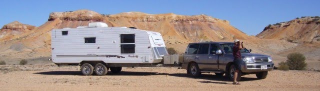
Next stop, just 400km up the road, was KALGOORLIE, the largest city in outback Australia. Much warmer here, around 35 deg - almost too hot but I didn't dare complain.

 Some of the amazing buildings in Kalgoorlie


So many mine sites in this area. About 100 years ago gold was discovered here and many prospectors had their individual mines until the 1980's when Alan Bond started buying up the small leases which were eventually taken over by Kalgoorlie Consolidated Gold Mines.
The ''Golden Mile'' is the richest square mile of gold bearing ore in the world.
When gold was first discovered men came in their thousands, many unprepared for the harsh conditions they encountered with inadequate food and scarcity of water. There was no sanitation and few medical supplies. Thousands died from thirst or disease. Nevertheless stories of fame and fortune spread rapidly and within a few short years 93 hotels and 8 breweries had been established.
Water shortages were finally relieved in 1903 through the genius of the State's Chief Engineer C Y O'Connor. The building of a water pipeline from Mundaring Weir in Perth, some 563 km to the Goldfields, ensured that the city prospered. Sadly C Y O'Connor was so harshly criticised he took his own life before the pipeline was finished. It's still in use today.
Left Kalgoorlie 7.30am and drove 200km back down the road to Norseman for morning tea then headed east another 330km where we freecamped at the end of the longest stretch of straight road in Australia 146.6km. Gorgeous clear night and before the moon came up you felt you could almost touch the millions of stars.
The scenery on the Eyre Highway (commonly known as the NULLARBOR PLAIN) is very ordinary but there was one awesome view of the Roe Plains as we dropped down through the Madura Pass from an escarpment - which we didn't know we were on!

 |
| A long straight road ahead |
 |
| Our camp spot on the Nullabor Plains |
 |
| and the sunset before the lightning storm |
 |
| The Bunda cliffs of the Nullabor |

Next day left 6.30am (light by 4am as WA has no daylight saving at this stage) and drove another 530km stopping at Eucla for lunch after which the scenery improved.
Several km before Eucla we came across a Japanese cyclist who had puncture problems so we loaded his cycle, trailer and various heavy packs into our vehicles and took him to Eucla where John found his problem and they fixed it. I told him I thought he was crazy riding across the Nullabor and he said ''I think so''. These last two days have been extremely hot and the kms go on forever.
Eucla has a population of 47, 7 of which are policemen. They always work in twos, patrolling the highway, manning the station, closing the border while one has a day off.

Eucla has a population of 47, 7 of which are policemen. They always work in twos, patrolling the highway, manning the station, closing the border while one has a day off.

After Eucla we left WA after 4 months and crossed into S.A. at Border Village where we advanced our clocks 2 1/2 hours ahead of WA. We checked out the various viewing areas of the coastline Bunda Cliffs overlooking the Great Australian Bight which look spectacular but also dangerously unstable. The southern ocean was calm! (The calm before the storm).
We freecamped overnight at a cliff viewing site, with two other caravans, and watched a magnificent sunset before the ''fireworks'' started.
We have never seen so much lightning ever and John loved every minute of it!! It lasted about 6 hours getting closer and more spectacular with loud claps of frightening thunder. But it was the ferocious wind that was the most scary. It wasn't a steady wind but came from all directions and in terrifying bursts.
Then it rained which was a blessing as the lightning had started several bush and grass fires in the area.
What a welcome to South Australia.
And so to November 11th our 39th wedding anniversary and our third and final day driving across the Nullabor Plain and Eyre Highway. Left camp at 9am, now we're in a more normal time zone, driving 345km today.
The Eyre Highway (or Nullarbor Plain) was an experience but not one I'm in a hurry to do again. It's almost 1200 kms from Norseman in W.A. to CEDUNA in S.A. A few scenic spots, plenty of rest areas, lots of roadtrains, one or two sheep stations, several roadhouses, flies, some birds and the only other wildlife we saw was a rabbit but plenty of roadkill kangaroo. Wheat fields started about 100km from Ceduna. We had a slight tail wind for most of the 1200km drive, averaged 17litres per 100km at 90kph using 220 litres diesel.
We were expecting that we would be driving through many kms of treeless plain but, in fact, once in S.A. although we were crossing the Nullabor National Park for about 180 km we only drove through the treeless plain for about 15km.
The lightning continued in Ceduna and the thunder throughout the night was the whip cracking thunderous explosions and really scary.
Heavens, 2,500km in 8 days - time to take a rest!
We spent about 2 weeks around the EYRE PENINSULAR, staying at CEDUNA, STREAKY BAY, SHERINGA BEACH, COFFIN BAY, PORT LINCOLN, and WHYALLA. We enjoyed all these places but I think the highlight for me was the Coffin Bay National Park where there were beautiful sandy beaches and also where the craggy high limestone cliffs fend off the full force of the south-westerly gales. Quite a spectacular drive.
 |
| Note the two sets of waves |


The peninsular is mostly grain crops and although they’re not used to much rain, and they had even less this year, there was still a reasonable crop.
and also going through the grain depot in Port Lincoln.
and also going through the grain depot in Port Lincoln.

There are huge inlets on the west coast where a lot of (very tasty) South Pacific oysters are grown. And it is also reputed to be a very good fishing area.
We had a mixture of weather from very cold, very windy, very hot, thunder and lightning and likelihood of bush fires. When the last really bad bush fire went through the Eyre Peninsular a couple of years ago it travelled about 50km across the Peninsular at about 1 km per minute with two people being killed and a caravan park being lost to the fire on the east coast. We’ve been told that if you have to leave a caravan park because of a bush fire you can only take your vehicle and must leave the caravan behind. It’s really very scary and this year because of the drought and everything is so dry the fire season has started 6 weeks earlier and there have been hundreds of fires already, some small but some have been out of control for several weeks.
We’ve also heard a new term: dry thunderstorms where there is only thunder and lightning and no rain. They occur when it’s very hot and windy, conditions we have had in the last week. A total fire ban has been in place for most of this week in a lot of areas.
We arrived back at PORT AUGUSTA after more than 6 months touring South Australia, Northern Territory and Western Australia where we’ve seen the most amazing sights, met so many friendly people and had a truly wonderful time.
December 2006
We spent a couple of days in the GRAMPIANS NATIONAL PARK where last January a massive fire, ignited by lightning on 20 January 2006, was eventually contained by 2 February.


 Images of the Grampians National Park


It burned 130,000 hectares of land including 47% of the Grampians. We had intended visiting this park about that time but thankfully decided on the Mornington Peninsular instead. So now we’re here and can see how nature is regenerating the trees and plant life. Still a long way to go but interesting to see nature take its course. Luckily the town of HALLS GAP was saved but only just.


 |
| Regeneration a year after the fire |
It burned 130,000 hectares of land including 47% of the Grampians. We had intended visiting this park about that time but thankfully decided on the Mornington Peninsular instead. So now we’re here and can see how nature is regenerating the trees and plant life. Still a long way to go but interesting to see nature take its course. Luckily the town of HALLS GAP was saved but only just.
We were very surprised, (considering the drought) to see a splendid waterfall, The MacKenzie Falls, with gallons of water rushing out of Lake Wartook. The walk to the bottom of the falls was a test for the heart (actually it was the walk back up) and then later in the day we drove 10km up Mt William and then walked the last 2 steep km to the top - 1,167m - the highest peak in the park. But we live to tell the tale and the views were quite spectacular. The Grampians are the southernmost end of the Great Dividing Range.
We drove back through the Great Ocean Road to Ocean Grove where we once again enjoyed the hospitality of Kay and Gary before flying home to NZ mid December for two or three months.
The conditions in Australia right now are not conducive to the life we like to lead here. The drought is really bad, most places are on very severe water restrictions and the bush fires are out of control.
The conditions in Australia right now are not conducive to the life we like to lead here. The drought is really bad, most places are on very severe water restrictions and the bush fires are out of control.
Please let it rain soon.